Introduction
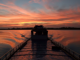
Within Arakan, the Kaladan is far more than a single river channel. It is the central artery of a larger geographical system linking mountains with coastal plains and the Bay of Bengal. Monsoon rainfall falling across its upper watershed is collected by streams and tributaries, transported through the main river and ultimately discharged into the coastal environment. Along the way, the river carries sediment, nutrients and freshwater that influence agricultural plains, wetlands, fisheries, mangroves and the estuarine ecosystems around Sittwe.
The Kaladan has also served as a major human corridor. Settlements developed along its banks because the river provided water, fish, fertile agricultural land and transportation. Before the expansion of modern road networks, river travel was among the most practical ways of moving people and goods between central Arakan and the mountainous interior. In the twenty-first century, this ancient geographical corridor has acquired new international importance through attempts to connect Sittwe with Paletwa and northeastern India by a combination of maritime, inland-waterway and road transport.
A River Linking Mountains and Sea
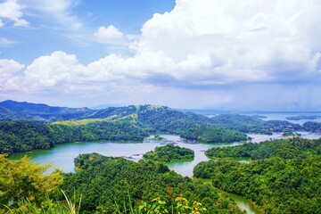
Farther south, the main river enters progressively lower terrain. Its valley widens, the gradient decreases and sediment begins accumulating across broader floodplains. By the time the Kaladan reaches central Arakan, it has become a large lowland river capable of forming islands, side channels and extensive riverbanks.
Near Sittwe the river enters a tidal environment. Freshwater flowing from the interior encounters saline water moving inland from the Bay of Bengal. The lower Kaladan therefore becomes an estuarine system rather than remaining an entirely freshwater river. This transition from mountain stream to broad river and finally tidal estuary makes the Kaladan an excellent example of how Arakan's mountains, rivers and coast operate as one connected geographical system.
The Upper Watershed
The upper Kaladan watershed lies within the rugged mountain systems north of central Arakan. Rainfall draining from steep hills enters numerous streams that combine into increasingly large river channels.
The watershed is part of the wider Indo-Burman mountain environment. Steep slopes, folded geological formations and intense monsoon rainfall strongly influence river behaviour. During the wet season, tributaries can carry enormous quantities of water and sediment, while dry-season discharge is substantially lower.
World Bank environmental assessment describes the Kaladan as originating in the Chin Hills before flowing toward its lower floodplain and estuary. The upper catchment includes important forest environments belonging to the Chin Hills–Arakan Yoma and neighbouring ecological regions.
The Transboundary Kaladan System
The Kaladan is a transboundary river system. Its upper drainage extends across the mountainous borderlands linking present-day India and Myanmar before the main river turns southward through western Myanmar toward Arakan.
This modern international geography should be distinguished from the much older physical geography of the river. The Kaladan watershed existed long before present political borders were established. Mountain communities, river settlements and trading networks developed in relation to valleys and waterways rather than modern state boundaries.
Today, however, international boundaries give the river additional geopolitical importance. The upper basin reaches toward India's northeastern region, while its lower course provides direct access to the Bay of Bengal through Arakan. This combination explains why the Kaladan has become central to modern transport planning between India and Myanmar.
The Kaladan through Paletwa
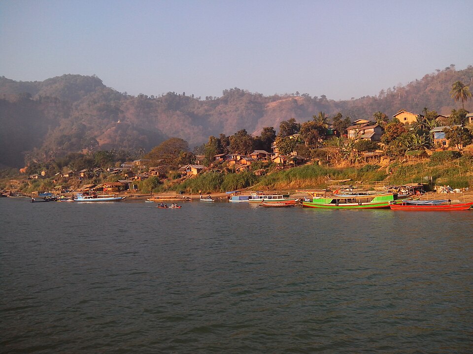
The river historically provided Paletwa with a natural transportation route toward Arakan and the Bay of Bengal. Mountain roads in this terrain are difficult to construct and maintain, particularly during the monsoon, whereas the river offers a continuous geographical corridor through the valleys.
This geographical advantage later became central to the Kaladan Multi-Modal Transit Transport Project, which planned an inland-waterway connection between Sittwe and Paletwa before transferring cargo to an overland route toward India.
Entry into Central Arakan
As the Kaladan flows southward, the landscape gradually changes from confined mountain valleys toward the wider plains of central Arakan. The river becomes broader and its surrounding terrain increasingly suitable for permanent agriculture and larger settlements. This transition is particularly important geographically. Water moving rapidly through steep uplands carries sediment eroded from mountain slopes. When the river reaches flatter terrain and its velocity decreases, some of this sediment is deposited.
Over generations and geological periods, repeated flooding and sediment deposition have helped construct the fertile alluvial landscape associated with the lower Kaladan. The river is therefore not simply flowing across the plain; it has actively participated in creating that plain.
Kyauktaw and the Kaladan Valley
Kyauktaw is one of the principal towns directly associated with the Kaladan in Arakan. It occupies an important position where river transportation, agricultural lowlands and routes toward the northern and eastern highlands intersect. The surrounding Kaladan valley contains extensive cultivated land. Rice fields occupy suitable low-lying plains, while villages commonly occur along riverbanks, roads and slightly elevated ground less exposed to ordinary seasonal flooding.
Kyauktaw's geographical importance extends beyond the size of the town itself. It occupies a natural corridor connecting central Arakan with upland regions. Control of movement through this corridor has consequently carried economic and strategic importance during different historical periods.
The Kaladan Floodplain
Southward from the mountain valleys, the Kaladan develops a broad floodplain. Floodplains form when rivers periodically overflow their channels and spread water and sediment across neighbouring lowlands. These processes can create exceptionally productive agricultural soils. Fine sediment carried downstream settles when floodwater slows, gradually replenishing the land with mineral material derived from the upper watershed.
Floodplains are nevertheless dynamic environments. Riverbanks can erode, channels can shift and low-lying fields may remain underwater during severe floods. Human settlement therefore involves a continuing balance between the benefits of fertile river land and the risks created by flooding.
River Islands and Multiple Channels
One notable feature of the lower Kaladan is the development of river islands and multiple channels. World Bank basin assessment specifically notes that when the Kaladan reaches its floodplain it broadens and develops islands and branching channels.
These features form because sediment is continually being transported and redistributed. Where flow slows, sand, silt and other material can accumulate. Vegetation may eventually colonize stable deposits, while subsequent floods reshape or remove other islands. The result is a river landscape that changes over time. Channels visible in one period may become shallower or shift position, while new sandbanks and islands appear elsewhere.
Sediment from the Mountains
Sediment is one of the most important but least visible components of the Kaladan system. Every monsoon, rainfall erodes material from mountain slopes and riverbanks throughout the watershed. Streams carry this sediment into larger tributaries and eventually into the main Kaladan. Coarser material tends to settle earlier, while finer silt and clay can travel much farther downstream.
This process links distant mountain forests directly with Arakan's coastal geography. Changes in land cover or erosion hundreds of kilometres upstream can influence sediment levels in the lower river and estuary.
Ponnagyun and the Lower River Region
As the river approaches the coastal lowlands, the surrounding geography becomes increasingly influenced by tidal waterways and the broad estuarine environment associated with Ponnagyun and Sittwe.
The landscape here is lower and flatter than around Kyauktaw. Rivers, creeks, wetlands and agricultural plains intersect one another, creating a geographical transition between inland river valley and coast. Settlements depend upon both land and water transportation. Rice cultivation occupies suitable plains, while fishing and riverine livelihoods become increasingly important toward the estuary.
The Kaladan Estuary
The Kaladan estuary begins where the lower river increasingly responds to tides from the Bay of Bengal. An estuary is not simply the final section of a river; it is an environmental transition zone where freshwater and seawater interact.
Tides periodically push saline water upstream while river discharge pushes freshwater toward the sea. The balance changes according to season, rainfall, river flow and tidal conditions.During the monsoon, enormous quantities of freshwater and sediment move toward the coast. During the drier season, reduced river discharge allows tidal influence to become more pronounced farther upstream.
Sittwe and the Mouth of the Kaladan
Sittwe, historically known as Akyab, occupies the coastal zone at the lower end of the Kaladan system. Its geographical position near the river mouth was fundamental to the city's development.
The site provides access both inland and outward to the Bay of Bengal. Agricultural produce and other goods could travel downstream from the interior and then be transferred to maritime vessels. Conversely, imported goods could enter through the coastal port and move inland through the river network. This river–sea connection helped transform Akyab into an important port during the colonial period and continues to explain Sittwe's strategic importance today.
The Kaladan and the Bay of Bengal
At its mouth, the Kaladan becomes part of the larger Bay of Bengal system. Freshwater, nutrients and sediment carried from the watershed enter coastal waters and influence marine and estuarine ecosystems. The river's influence does not end at the shoreline. Sediment contributes to coastal landforms, while freshwater discharge changes salinity and nutrient conditions offshore.
World Bank environmental assessment identifies the Kaladan as particularly important for maintaining coastal processes, including sediment supply to areas containing mangrove forests. The mouth of the river is also associated with an important marine biodiversity area.
A Living River System
The Kaladan should therefore be understood as a living geographical system rather than a fixed blue line on a map. Its mountains collect rainfall; tributaries gather water; the main river transports sediment; floodplains store water and support agriculture; wetlands provide habitat; the estuary mixes fresh and salt water; and the Bay of Bengal receives the river's discharge.
Changes in any one part of this system can affect another. Deforestation in the upper watershed may increase erosion. Alteration of river channels can influence flooding. Dredging can change sediment movement. Loss of wetlands can reduce natural flood storage, while changes in freshwater flow can affect estuarine ecology. For this reason, the geography of the Kaladan must be studied from its watershed to its mouth rather than examining individual sections in isolation.
The Kaladan River in Rohingya Memory of the 1942 Massacres
For Rohingya, the Kaladan River carries memories that extend far beyond geography, agriculture and transportation. In Rohingya oral history, the river is closely associated with the communal massacres and mass displacement that devastated Muslim communities in Arakan during 1942, when wartime political collapse and intercommunal violence transformed large areas of the region.
Accounts transmitted by Rohingya elders describe large numbers of Muslims being killed in areas connected with the Kaladan valley and central Arakan. A particularly powerful memory repeated within the community is that the Kaladan River appeared to run red with the blood of those killed, with some elder accounts describing this condition as continuing for an extended period, sometimes remembered as more than two months. Such descriptions belong to survivor testimony and intergenerational Rohingya memory and should be understood in that context rather than as a scientifically documented measurement of the river's condition.
Rohingya historical narratives also preserve very high estimates of the number of Muslims killed during the 1942 violence, with some community accounts placing the death toll at approximately 140,000. This figure remains part of Rohingya historical memory, but casualty estimates for the 1942 violence vary substantially among historical sources and cannot presently be treated as a conclusively established total. Rohipedia therefore records the figure as a Rohingya community estimate, while distinguishing it from independently verified casualty statistics.
What is firmly established is that the violence of 1942 caused extensive killing, destruction and forced population movement and profoundly changed the demographic geography of Arakan. Muslim communities were driven northward from several central and southern areas, while Rakhine communities were also displaced from parts of the north. For Rohingya historical consciousness, however, the loss of Muslim communities from areas around the Kaladan and central Arakan represents one of the defining catastrophes of the twentieth century.
The Kaladan consequently occupies two places in Rohingya memory. It is one of Arakan's great geographical arteries, sustaining agriculture, settlements, fisheries and communication; but it is also remembered as a witness to mass violence. Elder testimony concerning bodies, killings and the blood-red river has helped transmit the trauma of 1942 to generations born long after the events themselves.
Preserving these accounts is historically important precisely because oral memory records dimensions of mass violence that administrative documents may omit. At the same time, responsible documentation requires Rohipedia to identify clearly what comes from survivor testimony, what represents later community estimates, and what can be corroborated through contemporary records and independent historical research.
The Kaladan as a Human Landscape
The history of the Kaladan cannot be separated from the communities that settled along its banks. Water, fertile alluvial soil, fish, transportation and access to the Bay of Bengal made the river valley one of the most important human landscapes of Arakan.
Settlements developed particularly where elevated riverbanks provided some protection from ordinary flooding while remaining close to cultivable land. Smaller villages occupied agricultural plains and tributary valleys, while larger settlements emerged at locations important for river transport, administration and trade.
This relationship between people and river changed over time, but its basic geographical logic remained remarkably persistent. Communities needed access to water and agricultural land, while the Kaladan provided a natural transportation corridor through terrain otherwise divided by mountains and forests.
An Early Centre of Settlement
The Kaladan valley was important long before the modern towns along the river developed. Archaeological and historical research places some of Arakan's earliest substantial political centres within the wider Kaladan landscape.
The British Museum describes the earliest major kingdoms of Arakan as developing approximately 1,800 years ago in the Kaladan River valley, where fertile floodplains supported rice cultivation. The surrounding hills and waterways created an environment capable of supporting substantial settled populations.
The river was therefore connected not merely with individual villages but with the emergence of complex societies in Arakan. Agricultural surplus from fertile plains could support rulers, religious institutions, craftsmen and trading communities beyond the immediate farming population.
River, Floodplain and Rice
Rice became one of the defining products of the Kaladan lowlands. The combination of monsoon rainfall, warm temperatures, alluvial soil and relatively broad plains created favourable conditions for wet-rice cultivation.
Fields occupied low terrain surrounding villages, while embankments, drainage channels and natural waterways helped determine how water moved across agricultural land. Farmers adapted cultivation to the seasonal rhythm of the monsoon rather than attempting to separate agriculture entirely from the river's flood cycle.
The Kaladan consequently shaped both where people lived and how they produced food. Fertile land encouraged settlement, and settlement in turn transformed natural floodplains into increasingly extensive agricultural landscapes.
River Transport
For generations, the Kaladan functioned as one of Arakan's principal natural highways. Roads through western Myanmar were historically limited by mountains, forests, rivers and intense monsoon rainfall. Boats could move along the river more efficiently than people or heavy cargo could travel across difficult overland terrain.
Small craft connected villages with local markets, while larger vessels transported agricultural produce and other commodities downstream. Colonial geographical descriptions regarded the Kaladan as the largest and most important river of Arakan and recorded substantial navigability inland from Akyab. River transport was therefore not secondary to Arakan's geography. It formed part of the basic transportation system upon which agricultural and commercial life depended.
Tidal Navigation
The lower Kaladan is strongly influenced by the tides of the Bay of Bengal. This tidal character historically assisted navigation by allowing vessels to move inland from the coast with favourable water conditions. Ships and boats could enter the river system from the Bay and travel toward inland markets. Conversely, rice and other goods produced within the river valleys could be transported downstream toward coastal ports.
The connection between tidal river and sea helped integrate inland Arakan with wider maritime trading networks. The Kaladan was therefore simultaneously an inland river and a gateway to the Indian Ocean world.
Exchange between Lowlands and Highlands
The Kaladan also connected ecologically different regions. The lowlands produced rice and other agricultural goods, while upland areas supplied forest and mountain products. Historical research describes exchanges involving products such as beeswax and lac from the highlands, while the lowlands produced agricultural surplus. The river provided the geographical route through which these goods could reach markets.
This exchange illustrates an important feature of river-basin economies: communities occupying different environments could specialize in different products while remaining economically connected through waterways.
Connection with the Bay of Bengal
At Sittwe, the Kaladan opens directly toward the Bay of Bengal. This gave communities of the river basin access to maritime networks reaching Bengal, India and other parts of the Indian Ocean.
Arakan's maritime trade was not confined to a single historical period. Different political eras produced different commercial relationships, but the geographical foundation remained the same: river systems connected productive inland areas with ports facing the sea. The Kaladan consequently helped make central Arakan a meeting place between inland Southeast Asian geography and the maritime world of the Bay of Bengal.
Akyab and the Colonial Rice Economy
After the British annexation of Arakan in 1826, the river's commercial importance expanded dramatically. Akyab, now Sittwe, developed into the principal colonial port of Arakan near the mouth of the Kaladan. British rule encouraged a major expansion of rice cultivation across the fertile lowlands. Wetlands and less intensively cultivated land were increasingly transformed into paddy fields, while river transport connected these agricultural areas with Akyab.
The Kaladan became one of the principal routes through which rice reached the port. Historical assessments of Burma's transportation system continued to describe the Kaladan and its tributaries as especially important for carrying rice to Akyab even well into the twentieth century.
Transformation of the Agricultural Landscape
The colonial rice economy altered the human geography of the Kaladan basin. Increased demand for agricultural production encouraged expansion of cultivated land, investment in rice processing and movement of labour into productive areas.
This transformation did not create settlement in Arakan from nothing. The Kaladan valley possessed a much older agricultural history. Colonial rule instead greatly intensified the commercial use of an already productive landscape and connected it more directly with international markets. The resulting changes affected landholding, labour relations and population distribution and became part of the wider colonial transformation of Arakan.
Communities of the Kaladan Basin
The Kaladan basin has never belonged to a single community. Its upper and lower reaches contain populations with different languages, religions, livelihoods and historical experiences.
Upland areas are associated particularly with Chin and other highland communities, while the central and lower valleys have contained Rakhine, Rohingya and other Muslim communities as well as additional groups. The river linked these populations geographically even when their political and cultural identities differed. Markets, transportation and agricultural exchange created relationships between mountain, valley and coastal communities.
Muslims of the Kaladan Region
Muslim settlement formed an important part of the human geography of central Arakan before the great demographic upheavals of the twentieth century. Muslim communities existed in townships associated with the Kaladan and neighbouring river systems, including areas around Kyauktaw, Ponnagyun, Mrauk-U and farther south and west.
Their history forms part of the wider development of Arakan's Muslim population over many centuries. Court service, maritime connections, local settlement, migration and agricultural expansion all contributed at different periods. The concentration of the modern Rohingya population farther north should therefore not be projected backward as though Muslims had historically been confined only to Maungdaw and Buthidaung. The communal geography of Arakan changed profoundly during the twentieth century.
The Crisis of 1942
The most traumatic transformation of the modern human geography surrounding the Kaladan occurred during the 1942 violence in Arakan. The collapse of British authority during the Japanese advance created conditions in which severe intercommunal violence spread through large areas of the region.
Muslim communities across several central-Arakan townships suffered killings, destruction and displacement. Rohingya political and historical accounts describe the events not simply as spontaneous communal rioting but as large-scale massacres that emptied numerous Muslim settlements.
The violence subsequently spread northward and was followed by retaliatory attacks against Rakhine communities in northern Arakan. The result was a profound demographic division: Muslim populations became increasingly concentrated in the north while many Rakhine communities displaced from northern areas moved southward.
Sultan Mahmud's Account of the 1942 Violence
One of the important Rohingya/Muslim political accounts was given by Sultan Mahmud, who later served as Burma's Minister of Health and represented northern Arakan in parliamentary politics.
Writing in The Nation in 1959, Sultan Mahmud rejected the description of the 1942 events as merely a communal riot. He described the violence against Muslim villages as organized massacre and identified extensive destruction across Myebon, Minbya, Pauktaw, Mrauk-U, Kyauktaw, Ponnagyun, Rathedaung and Buthidaung.
His published account listed 294 Muslim villages as having been destroyed across those townships. He stated that many survivors escaped northward toward Maungdaw, while approximately 22,000 eventually reached a refugee camp in Rangpur in British India.
These figures represent Sultan Mahmud's contemporary political account and should be identified as such rather than treated automatically as a complete statistical reconstruction of all wartime casualties. Nevertheless, his testimony is important evidence of the enormous geographical displacement experienced by Arakan's Muslim population.
Kyauktaw and the Destruction of Muslim Villages
The Kaladan town of Kyauktaw occupies a particularly important place in this history. Sultan Mahmud's account listed 78 Muslim villages in Kyauktaw Township as destroyed during the 1942 violence one of the largest township totals in his enumeration.
This destruction profoundly affected the human geography of the Kaladan valley. Communities that had occupied agricultural villages and river settlements were killed, dispersed or forced toward safer areas. For Rohingya historical memory, the disappearance of these communities is an important explanation for why the modern Rohingya population became concentrated overwhelmingly in northern Arakan despite a much broader earlier Muslim presence.
The Kaladan in Rohingya Memory of 1942
The Kaladan River itself occupies a powerful place in Rohingya oral memory of the massacres. Accounts transmitted by Rohingya elders describe bodies and blood entering the river during the killing of Muslim communities in central Arakan.
One of the most striking memories repeated within the community is that the Kaladan appeared to flow red with the blood of massacred Rohingya, with some elder accounts remembering the river in this condition for an extended period, sometimes described as more than two months.
Such testimony should be preserved because oral history records how survivors and their descendants experienced and remembered mass violence. At the same time, the description should not be presented as a scientifically documented hydrological observation. It is an oral-history account and collective memory of catastrophe, expressing the perceived scale and horror of the killings along and around the river.
The Rohingya Estimate of the Dead
Rohingya historical narratives preserve very high estimates for the number of Muslims killed during the 1942 violence. Some community accounts place the number at approximately 140,000 Rohingya, while other Rohingya publications give different totals, including estimates around 100,000.
No single figure has been established conclusively through surviving demographic records. Wartime administrative collapse, population displacement, destruction of villages and incomplete documentation make precise reconstruction extremely difficult.
Rohipedia should therefore preserve the approximately 140,000 figure as a Rohingya community estimate, while clearly distinguishing it from independently verified casualty statistics. Recording uncertainty does not diminish the historical importance of the violence; rather, it separates the documented fact of mass killing and displacement from casualty totals that remain contested or difficult to verify.
Oral History as Historical Evidence
The memories of Rohingya elders are themselves historical evidence, even when every detail cannot be independently corroborated through written archives. Survivors of mass violence frequently preserve information absent from official administrative records: names of destroyed villages, escape routes, locations of killings, missing relatives, burial places and the experiences of flight.
Oral testimony nevertheless requires careful historical treatment. Memories can change over decades, and later generations may combine multiple experiences into shared narratives. The strongest historical method therefore preserves testimony while comparing it with contemporary documents, demographic evidence, maps and independent historical research.
For Rohipedia, this means neither dismissing Rohingya oral memory because colonial documentation is incomplete nor presenting every inherited numerical estimate as an established archival fact.
The River as a Witness in Collective Memory
For Rohingya, the Kaladan consequently possesses a meaning that ordinary physical geography cannot fully capture. It is remembered as a river of fertile land, settlements and communication, but also as a geographical witness to the destruction of Muslim communities in central Arakan. The story of the river turning red has become part of the language through which the catastrophe of 1942 is transmitted between generations. This gives the Kaladan a dual place in Rohingya historical consciousness: a life-giving river and a landscape of loss.
Demographic Consequences
The consequences of 1942 continued long after the immediate violence ended. Muslim survivors moved northward toward Maungdaw and Buthidaung, while Rakhine communities displaced from northern areas moved in the opposite direction. This movement reinforced an increasingly sharp communal geography. Northern Arakan became predominantly Muslim/Rohingya, while central and southern areas became increasingly Rakhine-majority.
The Kaladan region therefore provides an important example of how violence can transform geography. Rivers and agricultural plains remained physically unchanged, but the communities occupying them could be radically altered through massacre, flight and prevented return.
Lost Villages and Historical Geography
Documenting the Muslim villages that disappeared from the Kaladan basin and neighbouring central-Arakan townships should eventually become a separate Rohipedia research project. Historical maps, colonial gazetteers, census material, land records, survivor testimony and village-name lists could potentially be compared to reconstruct the pre-1942 settlement landscape.
Such work would allow Rohipedia to move beyond general statements about displacement and identify the geographical locations from which communities disappeared. This is particularly important because modern demographic maps can otherwise create the misleading impression that today's population distribution represents an ancient and unchanging settlement pattern.
Postwar River Life
After the Second World War, the Kaladan continued to function as a major transportation and agricultural corridor despite the demographic changes produced by the conflict. Boats carried passengers and commodities between inland settlements and Sittwe. Rice remained an important product, and the river continued to connect communities poorly served by roads.
A later country study of Burma described the Kaladan and its tributaries as particularly important for transportation along the Arakan coastal strip and especially for carrying rice to Akyab. The persistence of this role demonstrates how strongly physical geography continued to shape the regional economy.
From Traditional River Corridor to Strategic Route
The historical functions of the Kaladan—moving people and goods between inland valleys and the Bay of Bengal—have not disappeared. Instead, modern governments have attempted to transform this old geographical corridor into an international transportation route.
The concept underlying the modern Kaladan transport project is therefore not entirely new. For centuries, the river connected inland communities with Sittwe and the sea. What is new is the scale of engineering, international investment and geopolitical ambition associated with turning the river into a modern freight corridor connecting the Bay of Bengal with northeastern India.
Historical Significance of the Kaladan
The Kaladan River has influenced Arakan's history at several interconnected levels. Its floodplains supported early agricultural centres; its navigable waters connected inland settlements with maritime trade; its lower valley helped sustain the colonial rice economy; and its banks supported ethnically and religiously diverse communities.
The violence of 1942 added another historical layer. For Rohingya, the Kaladan became associated not only with settlement and livelihood but with massacre, displacement and the disappearance of Muslim communities from large areas of central Arakan. The river's history therefore demonstrates why geography cannot be separated entirely from human memory. A river may remain physically present while the societies occupying its banks undergo profound transformation.
The Kaladan in the Modern Era
In the twenty-first century, the Kaladan River has acquired an international strategic importance extending far beyond the communities living along its banks. The same geographical characteristics that historically made the river an artery between inland Arakan and the Bay of Bengal have led India and Myanmar to develop it as part of a modern multimodal transportation corridor.
The Kaladan Multi-Modal Transit Transport Project, generally abbreviated as KMTTP, seeks to connect maritime shipping in the Bay of Bengal with inland navigation on the Kaladan and then with roads leading toward India's northeastern state of Mizoram. At the centre of this system are Sittwe Port, the lower Kaladan River and the inland terminal at Paletwa.
The project demonstrates the continuing power of geography. Modern engineering has changed the scale of transportation, but the fundamental geographical logic is old: goods arriving from the sea enter Arakan at Sittwe, move inland along the Kaladan valley and then continue toward the mountainous interior.
Origins of the Kaladan Multi-Modal Project
India and Myanmar began developing the concept of a Kaladan transportation corridor during the 1990s. Detailed planning followed, and the two governments signed the principal framework agreement for the project in April 2008.
The purpose was to create an alternative transportation connection between India's eastern ports and its landlocked northeastern states. India's Northeast is geographically separated from the country's main landmass by the narrow Siliguri Corridor, while difficult mountain terrain increases transportation costs.
The Kaladan offered another possibility. Cargo could travel by sea from an Indian port to Sittwe, enter the Kaladan River, travel upstream to Paletwa and then continue by road toward Mizoram. India therefore regards the project simultaneously as an economic corridor, a regional-connectivity initiative and a strategically important alternative route to its Northeast.
A Three-Mode Transportation Corridor
The defining characteristic of the project is that it combines maritime shipping, inland-waterway navigation and road transportation rather than relying upon a single transport system.
The route begins with maritime shipping between India's eastern coast and Sittwe Port. Cargo arriving at Sittwe can then be transferred to vessels suitable for inland navigation. The second stage follows the Kaladan River from Sittwe to Paletwa, a distance officially described by the Government of India as approximately 158 kilometres.
At Paletwa, cargo is intended to transfer from river vessels to road transport. The road then continues toward the India–Myanmar frontier and ultimately connects with Mizoram. This multimodal structure is what gives the project its name.
Sittwe Port
The modern Sittwe Port occupies the most important maritime position in the project. Located near the mouth of the Kaladan, it provides the point at which ocean-going cargo can enter or leave the river corridor. Its selection reflects the same geographical advantages that helped Akyab develop as a colonial port. The lower Kaladan connects Sittwe with a substantial inland hinterland, while the Bay of Bengal provides direct maritime access toward India and the wider Indian Ocean.
The modern project has expanded port infrastructure so that Sittwe can handle larger and more organized cargo movements than the older facilities allowed.
Development of the Modern Port
Before the new project, India's Ministry of External Affairs described the old Sittwe port as having limited depth and infrastructure and as serving relatively small vessels. Cargo handled there included food products, construction materials, rice and other commodities.
Under the Kaladan project, new port and inland-waterway facilities were developed with Indian grant assistance. Infrastructure included cargo-handling areas, jetties and facilities associated with transferring goods between maritime and river vessels. The development was therefore not simply the construction of an isolated seaport. Sittwe was designed as the maritime end of an integrated transportation system extending inland along the Kaladan.
Sittwe Port Becomes Operational
A major milestone occurred in May 2023, when the first Indian cargo vessel associated with the operationalization of the new Sittwe Port travelled from Kolkata. The vessel carried 1,000 metric tonnes of cement in 20,000 bags. It departed Kolkata on 4 May and was received at Sittwe on 9 May 2023. The shipment demonstrated that the maritime component of the project could function physically between eastern India and Arakan.
The event was significant for Sittwe because it revived, in a modern infrastructural form, the city's longstanding geographical role as a port linking the Bay of Bengal with the river systems of inland Arakan.
Sittwe to Paletwa by River
From Sittwe, the project follows the Kaladan upstream toward Paletwa. The approximately 158-kilometre inland-waterway section is one of the project's most geographically interesting components because the character of the river changes considerably along the route.
Near Sittwe, the Kaladan is broad and tidal. Farther inland, the channel becomes increasingly confined by surrounding terrain. Navigating cargo vessels through these different environments requires knowledge of channel depth, seasonal water levels, sediment movement and river morphology. The project therefore depends upon the Kaladan not merely existing as a river but remaining sufficiently navigable for the vessels intended to use it.
Paletwa Inland Water Terminal
Paletwa was selected as the principal inland transfer point between river and road transportation. An inland-water terminal was constructed there to allow cargo arriving by river to be unloaded and transferred to road vehicles. Cargo moving in the opposite direction could similarly arrive by road and be transferred onto river vessels bound for Sittwe.
The terminal's location reflects Paletwa's position near the point where river transportation can provide access through difficult mountainous terrain before the proposed corridor turns toward the Indian frontier.
The Road toward Mizoram
From Paletwa, the project requires a road through mountainous terrain toward the India–Myanmar boundary. Indian government descriptions give the Myanmar-side Paletwa-to-border component as approximately 110 kilometres, followed by additional road connections inside India.
This road component has proven considerably more difficult than building the maritime port facilities. Mountainous topography, heavy monsoon rainfall, landslides, remote construction conditions and armed conflict have all complicated completion. The contrast demonstrates a fundamental geographical advantage of the Kaladan itself: moving through the river valley can be considerably easier than constructing permanent roads across surrounding mountains.
The Kaladan and India's Northeast
For India, the project is closely connected with the geography of its northeastern states. The Northeast is linked with the remainder of India through the narrow Siliguri Corridor. This makes alternative transport routes strategically attractive.
The Kaladan route offers access to Mizoram from the Bay of Bengal without requiring cargo to travel entirely through the traditional land corridor across northern India. Indian government descriptions have consequently emphasized both economic and strategic benefits, including lower transportation costs, improved access to northeastern markets and reduced dependence upon a single geographical corridor.
Arakan as India's Maritime Gateway
From the perspective of regional geography, the project places Arakan between India's maritime system and its northeastern interior. Cargo can move from the Bay of Bengal through Sittwe, travel up the Kaladan and then turn northeastward toward Mizoram. Arakan thereby becomes a geographical gateway rather than simply a coastal endpoint.
This role resembles older patterns in which Arakan's rivers connected inland regions with maritime trade, but modern infrastructure greatly expands the potential scale and strategic importance of those connections.
Economic Expectations for Sittwe
Indian government planning documents describe Sittwe as a potential regional transportation and commercial hub. The port could theoretically handle agricultural products, seafood, timber, petroleum products, textiles and other commodities exported from Myanmar, while construction materials and manufactured goods could enter through the same route.
If regional conditions permit sustained commercial operation, improved maritime and river transportation could reduce the cost of moving goods between parts of Arakan, northeastern India and external markets.
However, infrastructure alone does not guarantee that these benefits will reach local communities. Actual economic outcomes depend upon security, access, governance, commercial demand and the ability of local producers and traders to participate in the new transportation network.
Local Geography and International Strategy
The Kaladan project illustrates the difference between local geography and strategic geography. For people living beside the river, the Kaladan provides fish, agricultural land, water and transportation between neighbouring communities.
For India, the same river represents an international logistics corridor connecting the Bay of Bengal with Mizoram and the wider Northeast. For authorities controlling territory along the river, bridges, ports, terminals and transportation routes possess political and economic importance. These overlapping geographical perspectives can produce both opportunities and tensions because the river is simultaneously a local livelihood system and an international strategic asset.
Dredging and Navigability
Commercial inland navigation requires adequate channel depth. Rivers, however, continually move sediment, especially in monsoon environments such as the Kaladan. Sediment carried downstream can accumulate in shallower reaches and around bends, bars or river islands. Maintaining navigation may therefore require channel monitoring and, in some locations, dredging.
Dredging removes sediment from the riverbed to maintain or deepen navigable channels. While it can improve transportation, poorly planned dredging may alter river morphology, disturb aquatic habitat and change patterns of erosion and deposition. The environmental management of navigation consequently requires understanding the Kaladan as a dynamic sedimentary system rather than treating its channel as fixed infrastructure.
Seasonal Navigation
The monsoon produces major seasonal changes in river conditions.
During the wet season, water levels rise and the river carries substantially greater discharge. Higher water can improve depth in some reaches but may also create stronger currents, floating debris and dangerous navigation conditions.
During the dry season, lower water levels can expose sandbars and reduce channel depth. A commercial transportation system therefore needs to account for these seasonal changes when determining vessel size, cargo loads and navigation schedules.
Environmental Concerns
Large infrastructure projects can affect river environments through dredging, bank construction, port development, increased vessel traffic and associated roads. The Kaladan is particularly sensitive because it connects upland forests, riverine ecosystems, agricultural floodplains and an ecologically important estuary.
Changes in sediment movement can affect riverbanks and downstream coastal environments. Increased vessel traffic can create pollution risks, while construction can disturb local habitat. Environmental assessment therefore needs to consider the entire watershed rather than evaluating the port, river and road as completely separate projects.
Sediment and the Coast
One of the most important environmental issues is the movement of sediment.
The Kaladan carries material eroded from its upper watershed toward central Arakan and the Bay of Bengal. This sediment contributes to floodplains, river islands, estuarine environments and coastal landforms. Any engineering intervention that substantially alters sediment movement can potentially produce effects far downstream.
This is particularly relevant where coastal mangroves and mudflats depend upon continuing sediment supply to maintain their elevation relative to tides and sea level.
Fisheries and River Traffic
The Kaladan supports freshwater, estuarine and coastal fisheries. Increased commercial navigation may interact with fishing activity because both depend upon the same waterways.
Fishing boats generally operate at a much smaller scale than cargo vessels. Increased vessel traffic can therefore affect navigation safety and access to traditional fishing areas. Noise, wake, accidental pollution and riverbank infrastructure can also affect aquatic environments. These concerns do not necessarily make commercial navigation incompatible with fishing, but they demonstrate the need to consider local river users when developing major transport corridors.
Communities along the Corridor
Numerous communities live along or near the Kaladan between Sittwe and Paletwa. Their relationship with the project may differ substantially from that of national governments. Improved transportation can potentially create market access and employment, but construction and security restrictions may also affect land, fishing and local mobility.
A geographically responsible assessment therefore asks not only whether cargo can travel efficiently between India and Sittwe, but also how infrastructure changes the everyday landscape of communities through which the corridor passes.
Armed Conflict and the Kaladan Corridor
The project traverses an area that has experienced intense armed conflict. Fighting involving the Myanmar military, the Arakan Army and other armed actors has affected both Arakan and the Paletwa region. Roads, river routes, towns and infrastructure have strategic importance because controlling transportation corridors affects military as well as commercial movement.
Conflict has repeatedly complicated construction, transportation and maintenance. This illustrates another recurring feature of the Kaladan's history: because the river provides one of the most important natural corridors through western Myanmar, control over it carries strategic importance during both peace and war.
Changing Political Control
Recent conflict has significantly transformed political control across Arakan and adjoining areas. This creates uncertainty for infrastructure originally negotiated between the governments of India and Myanmar. Ports, roads and river terminals are physical structures, but their operation depends upon whoever exercises effective authority over the territory through which cargo must pass.
For the Kaladan corridor, political geography has therefore become as important as physical geography. The river remains where it has always been, but the authorities controlling its banks, towns and transportation routes may change.
Regional Connectivity
If the entire corridor eventually operates reliably, the Kaladan could become part of a broader network linking India, Arakan, Myanmar and the Bay of Bengal. Sittwe could serve maritime trade, the river could provide inland transportation, and road connections could extend toward Mizoram and other northeastern Indian markets.
Such connectivity would reinforce Arakan's historical position between South and Southeast Asia. The project therefore represents not simply a transport scheme but an attempt to reorganize regional economic geography around an ancient natural corridor.
The First Cargo and the Unfinished Corridor
The arrival of the first Indian cargo vessel at Sittwe in 2023 demonstrated that the maritime port component had become operational. It did not mean, however, that every component of the entire Kolkata–Sittwe–Paletwa–Mizoram corridor was fully functioning.
The river and road components have faced different stages of completion and operational difficulty. Indian government statements have continued to describe the project as moving toward full operationalization rather than as a completely finished corridor. This distinction is important for an encyclopedia article because the physical existence of port infrastructure should not be confused with continuous end-to-end commercial operation.
Expected Completion
Indian government statements published in 2025 indicated an expectation that the Kaladan Multi-Modal Transit Transport Project would become fully operational by 2027.
Such targets should be understood as government plans rather than guaranteed completion dates. Construction schedules in the region have repeatedly been affected by terrain, weather, logistical difficulties and armed conflict. Rohipedia should therefore record the date as the stated target at that time rather than predicting whether it will be achieved.
The Kaladan's Renewed Strategic Importance
The modern project has restored the Kaladan to the centre of regional strategic thinking. For centuries, the river connected agricultural settlements and inland communities with Akyab/Sittwe and the Bay of Bengal. Colonial trade expanded that role. Modern infrastructure now seeks to extend the corridor beyond Arakan toward northeastern India.
Technology has changed, but geography has not. The Kaladan remains valuable because it provides what the surrounding mountains make difficult: a natural route from the interior toward the sea.
Development and the People of Arakan
For Arakan, the most important long-term question is not simply whether the Kaladan becomes strategically valuable to neighbouring states, but whether development associated with the river improves the lives of the people who inhabit its basin. The river's agricultural plains, fisheries, settlements and ecological systems existed long before the modern transit project. Infrastructure should therefore be understood within this older human geography.
A successful transportation corridor could improve market access, employment and regional connectivity. But those benefits depend upon peace, equitable access, environmental protection and meaningful participation by local communities. The Kaladan's future should consequently be evaluated not only by the volume of cargo moving through Sittwe but also by whether the river continues to sustain the communities and ecosystems that have depended upon it for generations.
A River between Local Life and International Ambition
The modern Kaladan embodies a striking geographical contrast. At the village level, it remains a river of boats, fields, fishing grounds, seasonal floods and everyday movement. At the regional level, it has become an international transportation corridor linking India's eastern seaboard, Arakan and northeastern India.
At the strategic level, it provides access between the Indian Ocean and a politically sensitive continental frontier. These different scales now coexist on the same river. Understanding the modern Kaladan therefore requires seeing it simultaneously as a natural river system, a homeland landscape, an economic resource and an international strategic corridor.
The Kaladan as a Cultural Landscape
The Kaladan is not important to Arakan only because of its length, drainage basin or economic value. Rivers become part of the cultural landscapes of the people who live beside them. Generations have travelled on the Kaladan, cultivated its floodplains, fished its waters, crossed it to reach neighbouring villages and depended upon it for trade and communication.
For communities along the river, geographical knowledge developed through everyday experience. People learned the behaviour of tides, seasonal changes in water level, dangerous currents, productive fishing grounds and locations where boats could safely land. Farmers understood which lowlands retained monsoon water and which higher areas offered protection from ordinary flooding.
Such knowledge rarely appears prominently on political maps, yet it represents an important part of the human geography of the river. The Kaladan is simultaneously a physical watercourse and a lived landscape shaped by generations of interaction between communities and their environment.
Different Communities, One River System
The Kaladan basin passes through culturally and ethnically diverse areas. Highland communities, Rakhine settlements, Rohingya and other Muslim communities and populations around the coastal cities have all interacted with different parts of the river system.
Their histories and political experiences are not identical, and the significance they attach to particular locations can differ considerably. Nevertheless, the river physically connects these communities. Water descending from the northern mountains passes through the same system before reaching the agricultural plains and ultimately the Bay of Bengal.
This shared watershed illustrates an important geographical principle: political, religious and ethnic boundaries can divide populations, but river systems cross those boundaries. Activities upstream can affect people downstream regardless of community identity.
The Kaladan in Rohingya Historical Memory
For Rohingya, the Kaladan occupies a particularly painful place in historical memory because of the 1942 massacres and displacement in central Arakan.
Rohingya oral histories preserve accounts of Muslim villages being destroyed and their inhabitants killed or forced northward. The remembered image of the Kaladan becoming red with the blood of those massacred has been transmitted by elders as an expression of the enormous violence experienced by the community.
As discussed earlier in this article, some Rohingya oral accounts describe the river as appearing red for an extended period, sometimes remembered as more than two months. Rohipedia records this as Rohingya survivor and intergenerational oral memory, not as a scientifically documented observation of the river.
The distinction is important. Historical documentation should preserve the testimony of communities that experienced mass violence while remaining transparent about the kind of evidence being presented.
Remembering the Lost Muslim Geography of Central Arakan
The significance of the Kaladan within Rohingya memory also reflects the disappearance of many Muslim settlements from central Arakan.
Modern population geography can create the impression that Rohingya historical settlement was always overwhelmingly confined to Maungdaw and Buthidaung. The history of the 1942 violence complicates that picture. Muslim communities had existed across parts of Kyauktaw, Ponnagyun, Mrauk-U, Minbya and other central areas before wartime killing and displacement transformed the demographic landscape.
Reconstructing this earlier geography requires more than estimating the number of people killed. Historical village names, land records, colonial maps, census material, contemporary reports and oral testimony can potentially identify where communities lived before their destruction or displacement. The Kaladan basin should therefore become an important geographical area within Rohipedia's future documentation of pre-1942 Rohingya and Muslim settlement in Arakan.
Oral History and the River
Rivers often become powerful carriers of collective memory because they remain physically present after the people and settlements surrounding them have changed. A destroyed village may disappear from a modern map. Houses can vanish, agricultural fields can change ownership and administrative names can be replaced. The river, however, continues through the landscape.
For displaced communities, geographical features such as the Kaladan can consequently become anchors of memory. Stories associated with river crossings, markets, villages and massacres preserve a mental geography even when descendants can no longer visit those locations. Recording these memories alongside documentary sources can help reconstruct aspects of Arakan's historical landscape that would otherwise disappear.
Protecting Historical Memory
Future Rohipedia research should attempt to collect oral histories from elderly Rohingya whose families originated from central Arakan. Such documentation should record the original village name, township, nearby river or stream, family history, remembered escape route and names of neighbouring settlements whenever possible. Testimony should be preserved in the speaker's own language where feasible, accompanied by translation rather than replacing the original account.
Different testimonies should not be artificially forced into a single identical narrative. Where memories differ, those differences themselves should be documented. The goal should be to preserve evidence for future historical research rather than simply produce a predetermined casualty figure.
Environmental Future of the Kaladan
The future of the Kaladan depends upon maintaining the environmental processes that allow the river to function as an integrated watershed. Forests in the upper catchment influence runoff and erosion. Tributaries carry water and sediment toward the main river. Floodplains store monsoon water and support agriculture. Wetlands provide habitat and help regulate flooding. The estuary connects freshwater ecosystems with mangroves and the Bay of Bengal.
Development that considers only one section of the river can therefore create unintended consequences elsewhere. A river should be managed as a connected system from watershed to sea.
Forest Conservation
Protecting forests in the upper watershed is particularly important. Heavy monsoon rainfall striking exposed slopes can rapidly erode soil. Forest vegetation intercepts rainfall, roots stabilize soil and organic material improves the ability of the ground to absorb water. Removing vegetation does not automatically cause every flood, but widespread forest degradation can increase erosion and accelerate runoff.
Sediment produced upstream eventually moves downstream. Watershed conservation therefore benefits not only mountain ecosystems but also agricultural communities, fisheries and river navigation farther south.
Protecting the Floodplain
Floodplains are sometimes regarded primarily as unused land waiting for development, but their ability to temporarily store water is an important natural function. Construction that blocks drainage or occupies frequently flooded areas can transfer flood risk elsewhere. Embankments may protect one settlement while increasing water levels downstream if they substantially restrict the space available to the river.
Land-use planning around the Kaladan should therefore recognize that seasonal inundation is part of the natural river system rather than always treating flooding as an abnormal event.
Wetlands and Fisheries
Wetlands connected with the Kaladan support fish, aquatic plants, birds and numerous smaller organisms. They also provide resources to local communities. During the monsoon, expanded floodwaters can connect habitats that are isolated during the dry season. Fish may move between river channels, flooded fields, wetlands and tributaries.
Destroying these connections through poorly planned infrastructure can affect fisheries even when the main river channel remains apparently intact. Maintaining aquatic connectivity is therefore an important component of protecting the river's biological productivity.
The Estuary and Mangroves
At its lower end, the Kaladan interacts with one of Arakan's most important coastal environments. Sediment and freshwater delivered by the river influence tidal flats, wetlands and mangrove ecosystems. Mangroves in turn stabilize muddy shorelines, provide habitat for fish and crustaceans and offer some protection against waves.
These environments are particularly important in a region exposed to powerful tropical cyclones. Conservation of mangroves cannot prevent major disasters, but healthy coastal ecosystems can contribute to broader disaster resilience.
Pollution
Increasing transportation, urbanization and industrial activity create new pollution risks. Oil and fuel from vessels, untreated wastewater, plastic waste and construction material can enter river systems. Pollution introduced in one location can travel downstream and affect communities or ecosystems far from its source.
Because many people depend directly upon river water and fisheries, pollution is not merely an environmental concern. It can become a public-health and livelihood issue.
Development and Environmental Balance
The Kaladan transport corridor demonstrates the challenge of balancing infrastructure development with river conservation. Improved transportation can reduce isolation and create economic opportunities. Ports and waterways can connect producers with larger markets and provide alternatives to difficult mountain roads. At the same time, dredging, port construction, road building and increased vessel traffic can alter habitats and river processes.
The relevant question is therefore not whether development should exist at all, but whether it can proceed while preserving the environmental systems and local livelihoods upon which the population already depends.
Climate Change
Climate change adds another layer of uncertainty to the future of the Kaladan. Changes in monsoon rainfall could affect river discharge and flooding. More intense rainfall events could increase erosion and landslide risk within the mountainous watershed, while changes in dry-season conditions could affect water availability.
Near the coast, sea-level rise can increase saline intrusion and amplify the reach of storm surges into low-lying estuarine areas. The effects will vary across the basin, making long-term monitoring of rainfall, discharge, sediment and coastal change increasingly important.
Cyclones and the Lower Kaladan
The lower Kaladan and Sittwe region remain highly exposed to cyclones developing over the Bay of Bengal. Powerful storms can combine extreme rainfall, river flooding, strong winds and storm surge. These hazards may occur simultaneously, making estuarine settlements particularly vulnerable. Cyclone Mocha in May 2023 again demonstrated the exposure of Sittwe and surrounding areas to severe tropical weather.
Future planning around ports, settlements and river infrastructure must therefore account for extreme events rather than relying only upon ordinary seasonal conditions.
Conflict and Environmental Monitoring
Armed conflict creates additional difficulties for managing the Kaladan. Researchers and government agencies may be unable to access parts of the watershed. Environmental monitoring can stop, infrastructure may be damaged and displaced communities may be forced to rely more heavily upon nearby natural resources.
Conflict can also change who controls forests, ports, river crossings and extraction activities. Reliable environmental management consequently depends partly upon political stability and the ability of communities, researchers and responsible authorities to work throughout the watershed.
The Kaladan and the Future of Arakan
The Kaladan has the potential to remain one of Arakan's most important economic corridors. Its connection with Sittwe Port and the Bay of Bengal gives it significance for regional trade, while its agricultural and fishery resources remain essential locally.
Yet the future value of the river cannot be measured solely through cargo volumes or infrastructure investment. A river that carries international trade while local communities lose access to fishing grounds, agricultural land or safe water would represent a very different form of development from one in which connectivity improves local livelihoods.
The long-term future of the Kaladan therefore depends upon how regional economic ambitions are balanced with environmental protection and the rights and needs of communities living within the basin.
Geographic Chronology of the Kaladan
Ancient period — Fertile floodplains of the Kaladan valley support early centres of settled agriculture and political development in Arakan.
First millennium CE — Important urban and political centres develop within the wider Kaladan region, supported by agriculture and riverine-maritime connections.
Medieval and early modern periods — The Kaladan and adjoining waterways remain part of the transportation system connecting inland Arakan with coastal and Bay of Bengal trade.
1826 — British annexation of Arakan following the First Anglo-Burmese War begins a major colonial transformation of the lower river economy.
Nineteenth century — Akyab develops into a major rice-exporting port, while cultivation expands across the river plains of Arakan.
1942 — Wartime collapse and communal violence devastate Muslim communities across parts of central Arakan. The Kaladan becomes deeply associated with massacre and displacement in Rohingya oral memory.
Post-1945 period — The river continues functioning as an important route for rice, passengers and local commerce between inland settlements and Akyab/Sittwe.
2008 — India and Myanmar formalize the framework for the Kaladan Multi-Modal Transit Transport Project.
2010s — Construction progresses on Sittwe Port, inland-waterway facilities, Paletwa terminal and associated transport infrastructure.
9 May 2023 — Sittwe Port receives the inaugural Indian cargo shipment associated with operationalization of the modern port.
2020s — Armed conflict and changing territorial control complicate completion and operation of portions of the wider Kaladan corridor.
The Kaladan in the Geography of Arakan
Among Arakan's rivers, the Kaladan possesses exceptional geographical importance because of the scale and diversity of the landscapes it connects.
Its watershed begins in mountainous terrain. Its middle course passes through narrow valleys and upland settlements. Its lower course enters broad agricultural plains before widening into an estuary beside Sittwe and the Bay of Bengal.
Few geographical features illustrate more clearly the fundamental structure of Arakan: mountains behind the coast, rivers crossing the intervening landscape and maritime routes opening westward toward the Indian Ocean.
Historical Significance
The Kaladan helped sustain agricultural communities and early political centres, facilitated communication between highlands and lowlands and connected inland Arakan with maritime trade.
During colonial rule, it became an artery of the expanding rice economy centred on Akyab. During the violence of 1942, the river and its surrounding settlements became associated with one of the most traumatic episodes in Rohingya historical memory.
In the modern era, the same waterway has become part of an international transportation project connecting India, Arakan and the Bay of Bengal. These different periods are linked by geography. Political systems changed repeatedly, but the strategic importance of the river corridor persisted.
The Kaladan as a River of Arakan
The Kaladan should ultimately be understood first as a river of Arakan and its people.
International projects may give it strategic significance, but its deepest relationship is with the communities whose settlements, fields, fishing grounds and memories developed along its banks. For those communities, the Kaladan is not an abstract transport corridor. It is part of the landscape of everyday life.
For Rohingya in particular, it also carries memories of an earlier Muslim geography of central Arakan and of the catastrophic violence that altered that landscape in 1942.
Conclusion
The Kaladan River is one of the principal natural arteries of Arakan. From its mountainous watershed to its estuary at Sittwe, it connects forests, valleys, floodplains, agricultural settlements, wetlands and the Bay of Bengal within a single geographical system.
Its waters have supported rice cultivation, fisheries, navigation and trade for generations. Its floodplains helped sustain important centres of settlement, while its navigability connected inland communities with maritime commerce.
The river also carries difficult historical memories. The destruction and displacement of Muslim communities during the violence of 1942 transformed the human geography of the Kaladan basin and became deeply embedded within Rohingya collective memory. Oral accounts describing the river as red with the blood of those killed remain part of that inherited memory and should be preserved as testimony while being clearly distinguished from independently verified physical observations and casualty statistics.
Today, the Kaladan again occupies an international strategic position through Sittwe Port and the Kaladan Multi-Modal Transit Transport Project. Yet its significance cannot be reduced to infrastructure or geopolitics.
The river existed before modern borders, contemporary states and transportation projects. Its waters continue to connect mountain and coast, highland and lowland, agriculture and fisheries, local communities and the Bay of Bengal.
The future of the Kaladan therefore depends upon preserving this larger relationship. Economic development, environmental protection, historical memory and the interests of the people living within the watershed must be considered together.
For Rohipedia, the Kaladan represents more than a geographical feature. It is a river of settlement and agriculture, a historical route to the sea, a landscape of Rohingya memory and loss, an ecological system linking the mountains with the Bay of Bengal, and one of the defining geographical arteries of Arakan.